Maps (Part 2)
Here's the rest of the maps I drew last night, for those who are interested.
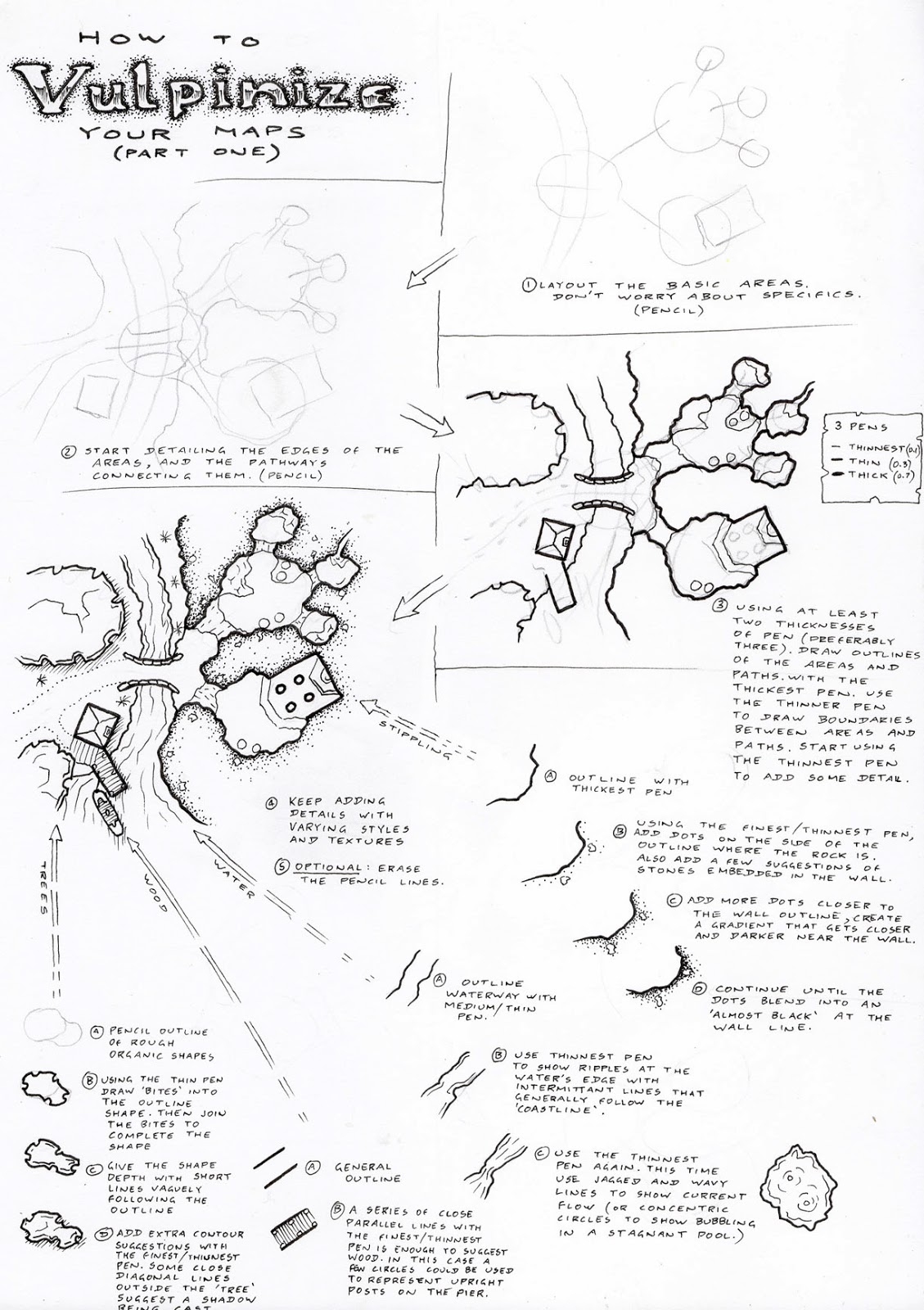
Presented in order...


Presented in order...
This was the first one. Just a random bunch of circles, jaggedly joined in pencil with sweeps of mountain ranges that might account for the coastlines provided. Rivers inserted logically from mountain ranges to deltas where they meet the sea. A few forests and fertile plains scattered about.
I had a rough idea for an island where two meteors, one large and one small had crashed into the world...or perhaps an ancient coral atoll where a huge explosion off to one side formed a new conjoined ring of land...or two volcanic eruptions. Starting with the rings of land and joining them with other landscape features that vaguely made sense, I ended up with this. I can see some good story potential in this one.
Not sure where I was going with this one. Just started with some vague squiggles that had a general point symmetry around the middle then built it from there.
This was an exercise in getting random shapes on the page to mesh coherently together in an organic landform. Bits of it don't seem "right", but it vaguely works. Perhaps there is an underlying magic in the area that has stabilised landforms that could not be forged naturally.
Something like a vaguely European/North African setting. Still quite a bit of work to go on this one.
Something vaguely like a pseudo-American setting. Just the coastlines so far.
.png)

Comments