Posts

Showing posts with the label Flatworld

A Narrative Outside Time and Space

Image
I remember when he was an enthusiastic sprite, I recall when he threatened the universe with his special blend of hubris and hate. I will have seen him at his weakest and his strongest.I will tell planar travellers things that they have only been able to reveal to me in riddles. Maybe I will tell them in riddles to prevent causality paradoxes, maybe they know better. In the grand scheme of things I will have been there at the beginning, and at the end.  To explain things best to you, the physical world is like a rippling pond when viewed from the outside. If you're outside the pond, you can throw a rock into it and watch the ripples spread outward. You can also see the ripples made by other people throwing rocks into the pond. I can't throw metaphysical rocks into reality, that's something I might have already told you about, or it might be something I tell you later, I can never tell how things work when you're stuck in linear time... I'm sure this gets discussed a...

An alternate way to draw maps (Part 4)

Image
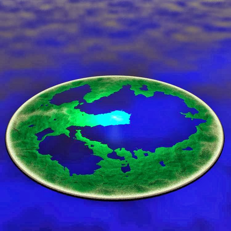
Now that we've drawn up the topographic map in Photoshop, we can do some interesting things with it. One of those things is to determine where water levels will be when the terrain is applied to Bryce...you don't need to export it across to Bryce to do that. Flatten the image (or select the whole thing, then do a "copy merged" and paste it into a new layer). Using this, you can go to "Image-> Adjusments -> Threshold". Since we now that light areas are higher than dark areas, we can set the threshold to a certain value...everything below that value will be underwater, everything above that level will be dry. Sliding the threshold value up and down gives us an effect like this...   When the threshold is set highest, it leaves only the outer rim mountains above the waterline, and when it is set lowest, there are only a few scattered lakes of water within the defined region. To keep things interesting, I like to make sure there is a balan...

An alternate way to draw maps (Part 3)

Image
When I draw 3D maps using Bryce and Photoshop, I deliberately don't plan them out too well. I have a vague idea of where I'd like things to go and let the twists and vagaries of fate push my maps in new and interesting directions. For this map, I open up a new image in Photoshop 2048 x 2048 pixels (since that's the Bryce scale for the terrain I'll be using). The first thing I do is draw a black circle on a black background. Specifically for this, I've added a thin outer glow (about 20 pixels) around the outside of the circle and a thicker inner glow (about 50 pixels) on the inside of the circle. Both of these glows are done with white. The circle is duplicated and applied as a screened layer directly over itself. The duplicated version of the circle has its outer glow inner glow expanded to 250. When converted to terrain this will vaguely give me a dish shape...flat in the middle with gentle slopes that get steeper toward the outer rim. The circular ...

An alternate way to draw maps (Part 2)

Image
To make this style of map in Bryce, it's pretty simple. Start with File>Document Setup. Make a viewing panel that fits your screen and for the moment, ensure its render resolution is 1:1. There are three sets of manipulation menus at the top of the screen (under the typical drop down menus that you find in almost every program)...they are called "Create", "Edit" and "Sky and Fog". When the "Create" menu is open, it shows a range of standard objects that can be added to a scene. These include (in order from left to right) planes, terrains, trees, rocks, "metaballs", a range of standard solids, flat 2D images and lights, the most recent version of Bryce then includes a tool that lets you export forms more easily to their other software packages.   All scenes in Bryce start with a flat plane. Here I've just created a terrain object, once selected, the terrain object shows a menu that allows a user to change the ob...

An alternate way to draw maps (Part 1)

Image
There is a software package called Bryce, it's been through a number of developers over its lifetime. Currently it is released by DAZ (you can find it here ). At various stages in its life it has been a free download, as I write this post, that is the case. Go, download it. It's a great 3D tool, and one of the best landscape modelling tools available. Muck around with it, especially the terrain tools, have a look online for some of the other great tutorials for it. It's one of the easiest 3D modelling programs to learn, and while it may not be as powerful as professional tools like Maya....it's free. I love creating maps using a graphic manipulation tool such as Photoshop and Bryce. Here's a little something I've been working on, I'll use a few steps to show you how I did it. The basic premise behind this map is simple. There is a concept called a Dyson sphere. It is basically a solid spherical shell of matter surrounding a star. Most inte...