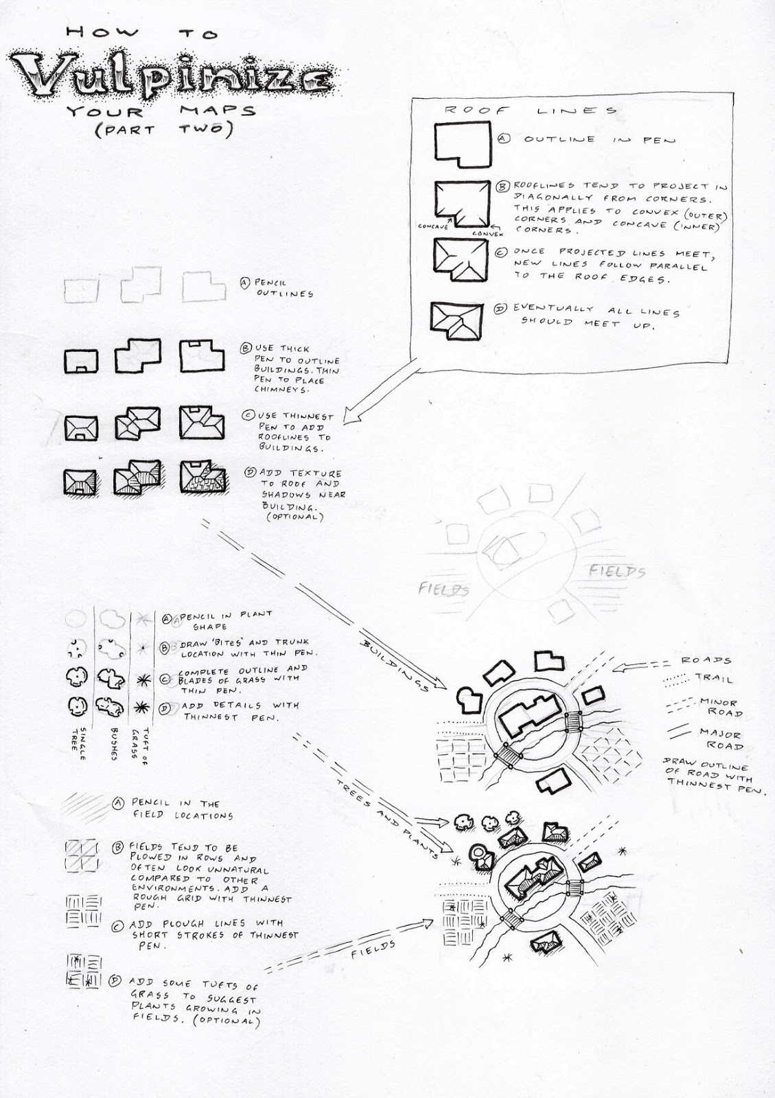
For this tutorial I've decided to shift my focus to slightly more urban environments, with some ideas for how to draw simple buildings, roadways, fields and specific plants that might be significant (such as orchard trees). The elements of this tutorial build on those from the previous post, and the further elements in later tutorials will continue to build with new ways to hatch and render, variant architectural styles, and specific types of features.
I'm hoping that this series will build up into a cartographers toolkit, where readers will be able to pick and choose a variety of techniques to develop a mapping style of their own.
Thanks for reading so far.
.png)
Comments